Community leaders on Haida Gwaii’s all-islands emergency planning team want detailed ocean-floor maps to plan for tsunamis and sea-level rise.
Responding to a recent request for new and improved bathymetry, the Canadian Hydrographic Service said it is already committed to surveying large parts of Haida Gwaii waters, and will do its best to prioritize areas close to the villages.
The Otter Bay, a dedicated survey ship of the Canadian Coast Guard, already did several surveys near Sandspit this May and June.
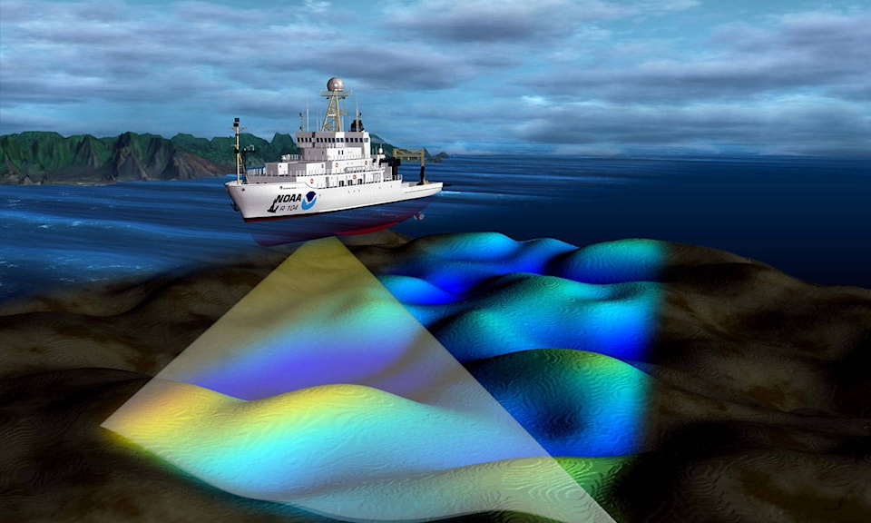
Using multi-beam sonar, such surveys produce high-resolution scans of the ocean floor that planners can be combined with land-based LIDAR (Light Detection and Ranging) maps to model how water might move up the coast.
“The maps that we have right now are good for planning in terms of where our safe zones are in our communities, but we want to have a better understanding of what climate change is going to do to us in terms of storm surges and water levels rising,” says Lori Wiedeman, chief administrative officer for the Village of Queen Charlotte.
“And then there is always the potential for tsunamis, with the Cascadia fault and other fault lines that we sit really close to.”
Wiedeman said the request from the All-islands Emergency Planning Committee, which includes members of every village and other local government on Haida Gwaii, followed after the tsunamipole project — a project that will soon see local hydro poles painted to mark the villages’ tsunami safety zone, which is six metres above the highest high tide line.
The villages got high-resolution LIDAR maps for that project, and now they just need similarly detailed ocean-floor maps for a complete picture.
The result could change how Haida Gwaii villages plan protective berms, erosion controls, or zoning for areas where it may be unsafe to build.