By John Wood
Toward the end of May, John Wesley and I set out from Gray Bay to hike the Cumshewa Head Trail to Kunxalas at the entrance to Cumshewa Inlet, and then on to Cumshewa village. For many years after I moved away in 1989, I would come back once a year to hike and maintain the trail, but I have let it slide for a few years.
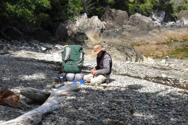
John picked me up at the Sandspit airport and we spent the first night camped at the near end of Gray Bay on the point by the mouth of the creek. Next we hiked to Gitz Cove (Kids Cove), the first of the small crescent beaches. With the vehicle access now ending less than halfway along Gray Bay, this first day’s walk could be more comfortably split into two days, for those carrying a heavy pack.
| The Cumshewa Trail trailhead. (John Wesley/Submitted) |
From the trailhead, down the beach from the concrete pad of the old LORAN site, the trail is in the trees just behind the driftwood. It swings well inland to avoid a blowdown area and emerges onto a point where the shoreline curves west into the wide crescent of Driftwood Beach. Three points of land are visible from this vantage — the farther one is Cumshewa Head. The small beaches, tucked in behind, are hidden by these points. The trail so far is in good shape.
The next section is the Bears’ Trail, behind Driftwood Beach. This is in good shape as far as the main creek, halfway down the beach. The salal sections need to be trimmed, but the bears have kept it open. The salal is tall, but the stems do not block the trail.
Beyond the main creek, as far as the end of the beach, the trail is no longer easy to find.
The next section involves beach-walking on granite outcrops with sections of shingle. John and I missed the place where the trail re-enters the woods, swings behind the most dangerous cliffs and crevices, and emerges onto the beach at Gitz Cove. We ended up lowering our packs down into an intertidal draw with rope, then used toeholds and fingerholds to along a slanting crevice and get down. On our return I relocated the trail, flagged it, and clipped out a patch of salal so we could go back that way.
The next day we walked through the woods at the end of the beach for a short distance, then walked the beach, the mostly worn-down granite outcrops, for about an hour. We found the Deer’s Trail that goes over the top of a difficult point with a sea cave, and emerged onto the beach at Jewel Cove. I had to clip out one patch of salal, otherwise the trail was in good shape, so I went back for John and the packs. The trail across the narrow peninsula to our destination Sandy Cove was not findable, so we ended up spending the night at Jewell Cove, no more than half an hour’s walk from our destination.
Several forays into the woods with compass and then along the shoreline out onto the impassable end of the peninsula did not solve the problem, so the next day, from the edge of the open part we just cut our way through the salal to the other side, following the compass. This one is now well marked.
| (John Wesley/Submitted) |
We spent the night at the beautiful beach of Sandy Cove— fine sand that goes way out at low tide. That is as far as we got.
From here the trail goes through the woods, emerges onto a steep beach of smooth white granite cobbles, then goes into the woods straight up a steep hillside. It stays in the woods all the way to Kunxalas. It comes down to the beautiful rugged shoreline of Cumshewa Head in several places, but does not go out onto the cliffs or down to the pocket beaches.
Take off the pack to explore these places! From Kunhalas, it is a two-day walk to Cumshewa village, along flat shoreline all the way. There is a good campsite on the beach behind Kingui Island.
I would be happy to come back and reflag the entire route, if folks here were prepared to trim it out again and keep it maintained. Better yet, a younger person could fall in love with Cumshewa Head and locate the route. When I make a trail I pick the easiest and safest way I can find, but sometimes it has to go through salal.
We saw many taan, black bear, on the beaches. We watched them pawing the windrows of seaweed at the end of the beaches, disturbing clouds of sand fleas which they would inhale into their mouths with short intake breaths. Once we saw two feeding near each other from the same pile. It takes them about an hour working the same area to get a feed.
This area is some of the original Haida Gwaii, and has never been logged except for some removal of “airplane spruce” behind McCoy Cove during one of the world wars. It is now protected as part of the Kunxalas Conservancy which extends along the outer coast from Copper Bay all the way to Gwaii Haanas, going around behind both Cumshewa village and Skedans along the way. Wonderful!
The Cumshewa Head Trail book, an account of a journey on the trail, illustrated and written by Aleta Karstad, with trail guide section by me, was published by the Wilderness Committee in 1989. It’s still available from them for half price. The foreword is by the late Gitkinjuuwaas, Charles Wesley, the previous Chief Cumshewa, and John Wesley’s father.