Mark Walsh is a trailblazer, but if he has a machete it stays home — his choice tools are garden clippers and a balsam walking stick.
Last fall, Walsh and his trail-building colleague Remi Gauthier pitched the idea of a hiking trail that goes up and along the plateau between Skidegate and Queen Charlotte.
Named after the late Chief Sgiidagids, Dempsey Collinson, it would rise up from Spirit Lake in the east, Crabapple Creek in the west, winding a way up and over creeks, old caterpillar trails, muskeg, hilltops, and stands of old-growth spruce and cedar.
Officially, the idea seems to be gaining steam, though it’s far from a sure thing. Most of the woods the trail would pass through are part of the Haida Gwaii Timber Supply Area.
But even though it’s not ready for prime time, Walsh and Gauthier have already blazed a kind of rough draft for a west-end loop that goes up Crabapple Creek and over east to Gore Brook before coming back down and connecting some of the “backyard” trails just behind Queen Charlotte.
Peeled balsam in hand, Walsh took the Observer on a well guided tour that still managed to lose the route a few times.
“It shows the whole history of human habitation on these islands,” Walsh said, who imagines eco-tourists would enjoy doing the hike with local guides who can speak to that history.
A short way up from the Crabapple Creek trailhead, Walsh and Gauthier found a surprise first exhibit — a rusting “diesel donkey” with its motor long gone.
“You would think it was a Mayan ruin or something, it was just totally covered with moss,” said Walsh, adding that some locals remember working the machine in the early 1950s. Together with a spar tree, it was used to yard logs from the surrounding hillside.
Next, the trail crosses Crabapple Creek — at a spot where local streamkeepers have made little eddies and waterfalls that mimic the big trees that once fell naturally across the creek, slowing its flow and building up gravel for salmon habitat.
In the “bad old days” of logging, Walsh said the creek was basically used as a skid row for giant spruce, though a few are still growing nearby, spared because they were too small at the time or somehow not shaped for easy hauling or milling.
After tunnelling through salmonberries, the proposed trail follows an old “cat” trail up and alongside the creek, crossing a couple of its tributaries. Here, the forest quickly shows its pre-chainsaw history — the largest stumps stand eight or 10 feet above the forest floor, marked by springboards.
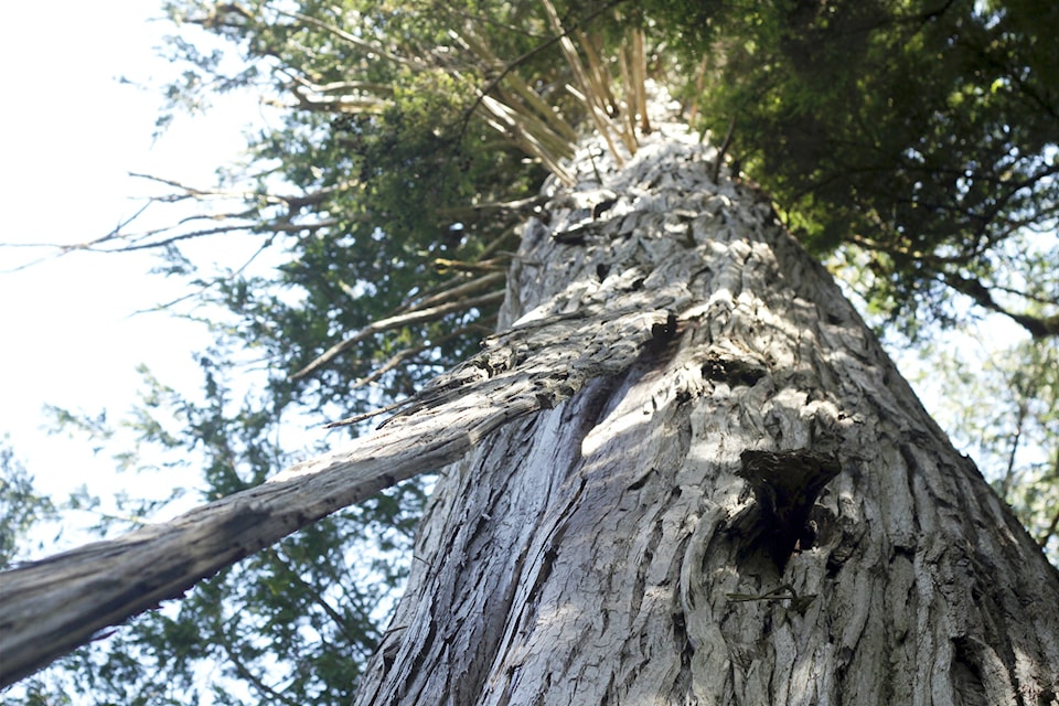
Not until the trail leaves the creek and begins climbing the slope in earnest are there any old-growth cedar.
But once they spotted the groves, Walsh and Gauthier routed the trail to meander past them. Sure enough, several show signs of Haida bark stripping, some way up the trunk, stretching over ages.
Walsh and Gauthier have had a little hi-tech help — GPS and LiDAR maps — but while they show ridges and gullies, the maps say nothing about the impassable hemlock thickets that grow up in blown-down clearings.
“It takes a lot longer than you think just to find the best route, never mind the rest of it,” said Walsh, a point that is underscored when the trail markers turn to flagging tape and the unfinished trail starts heading early, only two-thirds up to the plateau, and becomes harder to track as it follows the steeper Gore Brook back to Queen Charlotte.
Hours later, back at the mouth of Crababble Creek, the flat deck of an old herring gillnetter makes a welcome bench.
From here, Walsh hopes, someday hikers who have walked all the way from Skidegate will continue on, trading the woods for the intertidal as they round Hadyn Turner and cross the Honna on the way to Slatechuck Mountain.
“Our thinking is to have it as much wilderness trail as possible,” he said.