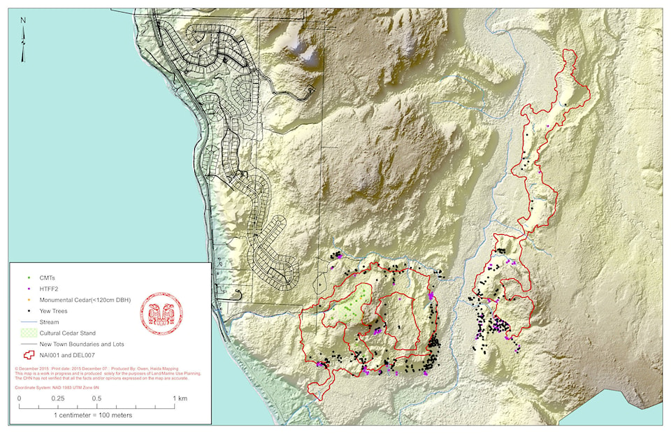
A study done last year found that logging two controversial cutblocks near Tlaa Gaa Aawtlaas/New Town would not increase the local risk of flooding.
The study found that logging the cutblock closest to the community would remove about a third of the trees from a small, 30-hectare watershed that drains into Masset Inlet through a stream running just south of the Tlaa Gaa Aawtlaas reserve.
But although the logging would likely cause a noticeable increase in the stream’s summer and winter flows, the study found it was unlikely to increase either the size or frequency of larger, potentially damaging floods.
“Harvest of the blocks will not increase flood hazard on the reserve,” wrote Drew Brayshaw, a senior hydrologist and geoscientist with Statlu Environmental Consulting.
BCTS No25-2016-Hydrologic Hazard Assessment DEL007 NAI001 by Andrew Hudson on Scribd
Using updated LiDAR mapping provided by the Council of the Haida Nation and fieldwork done by the Infinity-Pacific Stewardship Group, Brayshaw found there are five watersheds in the area, and existing provincial maps do not reliably show where they are or how they flow.
Of the five watersheds, Brayshaw found only the smallest, 30-hectare one would have a significant portion of its trees removed by logging of the two cutblocks in question.
However, Brayshaw also noted that logging has cumulative, non-linear effects on local water flows, so another flood-risk assessment would be needed if more cutblocks were planned in those watersheds.
Typically, Brayshaw said that logging 25 per cent or less of a watershed has a minimal impact, while logging 60 per cent or more results in more frequent and larger floods. Some of the factors include past logging, the rate at which trees are regrowing, canopy structure, storm size, as well as rainfall or snowmelt.
Brayshaw noted that the Masset area gets about 1,508 mm of rain and snow a year, with two-thirds of it falling between October and March. The extreme daily rainfall on record is 68 mm over 24 hours.