New ocean-floor surveys in Gwaii Haanas may soon reveal hidden shoals, submerged river beds, and likely marine habitats.
Ken Helcro, the lead hydrographer now aboard the Canadian Coast Guard Ship Vector, says Gwaii Haanas requested the surveys a few years ago.
“Our surveys of that area are fairly old, so we decided that would be good for us too, for updating our nautical charts,” said Halcro.
Among other things, high-resolution scans of the Haida Gwaii ocean floor have already helped researchers find evidence of old river beds and lakes in the western Hecate Strait and other places where the sea level was once about 150 metres lower.
Pollen taken from core samples suggests that 15,000 to 13,000 years ago, those freshwater areas supported a tundra of small shrubs and plants like willow, crowberry, grasses and sedge long before any pine, spruce, hemlock, or cedar began to grow.
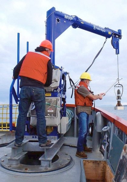
Working 24 hours a day on the Vector, the CCGS Otter Bay, and smaller boats like the CSL Shoal Seeker, Halcro and others with the Canadian Hydrographic Service have also used multibeam sonar technology to turn up dozens of previously unseen shoals.
“In other areas, they’ve analyzed our data and seen seismic faults they didn’t realize were there,” Halcro added, noting that better ocean-floor surveys also help researchers forecast how tsunamis might develop along the coast.
Previously, the Gwaii Haanas ocean floor was surveyed with sounders that only ran a profile every 100 or 200 metres, leaving hydrographers to guess if anything dangerous lay between.
Today’s sounders can achieve 100 per cent coverage, so long as ships can carry them.
The Vector can work in fairly rough seas, Halcro said, but it can go no shallower than 20 metres deep, while the Otter Bay and small Shoal Seeker can work in shallower, near-shore areas, but not in large swells.
Halcro said most surveys run May to September, when seas are typically calmer.
Over that same period, the team leaves tide gauges along the coast to capture actual tide data that can be used to improve tidal forecasting — a big help to Haida Gwaii fishers and surfers, as well as the mariners navigating the coast.
Besides Gwaii Haanas, the three Pacific survey vessels have been busy sounding Chatham Sound to provide a safer approach for ships going to Prince Rupert.
They have also done recent surveys of the Scott Islands in Queen Charlotte Sound — an ecologically protected area that marine biologists are keen to study.
Halcro said 20 years ago, he regularly surveyed places that had never been sounded before.
That is less common now, but even this summer, Halcro led surveys of a few blank spots and one partof the central coast where the existing dated to 1938.
“We actually found very few differences,” said Halco.
“That gives us a lot more confidence in our old surveys, so we can still use them to make charts.”